Methods of Land-cover Dynamic Monitoring Base on CBERS Data
-
1.
The Research Center of Forestry Remote Sensing and Information Engineering, Central SouthUniversity of Forestry & Technology, Changsha 410004, Hupnan, China
-
Received Date:
2007-10-28
-
Abstract
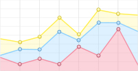
Obtaining land-cover information by classification method from remote sensing images was a basic andimportant project. The CBERS images of Zhuzhou City in 1999, 2003 and 2007 were classified with supervisedclassification methods based on the establishment of land-cover classification system, the land-cover information wasextracted and its dynamic changes were analyzed. The results indicated that: it was effective to use CCD data ofCBERS to monitor land-cover dynamic information by remote sensing in hilly areas in the middle of China. From1999 to 2007, the p roportion of forest land and water body and construction land were gradually increased inZhuzhou City, resulting in the decrease of farm land and other land. The increases of forest land and constructionland was sharp but the increasing rate became slightly. In conclusion, the results could p rovide some scientificevidence for the government of Zhuzhou City to make decision in land resources use and thesustainable development.
-

-
References
|
[R]. IGBP Report No. 35and HDP report No. 7, Stockholm and Geneva, 1995 |
|
[2]
|
Turner ⅡB L, Skole D L, Sanderson S, et al. Land-use and landcover change. Science / Research Plan |
|
[3]
|
王宜礼,蔡 伟. 我国资源一号卫星资料应用成果显著[J]. 遥感信息, 2003专题报道
|
|
[4]
|
刘建平,赵应时. 高光谱遥感数据解译的最佳波段选择方法研究[J]. 中国科学院研究生院学报, 1999, 16 (2) : 153-161
|
|
[5]
|
杨忠东,谷松岩,邱 红,等. 中巴地球资源一号卫星CCD图像质量评价和交叉定标研究[J]. 遥感学报, 2004, 8 (2) : 113-120
|
|
[6]
|
汪 静,杨媛媛,王鸿南,等. CBERS-1卫星02星图像数据质量评价[J]. 航天返回与遥感, 2004, 25 (2) : 34-38
|
|
[7]
|
黄妙芬,徐 曼,李坚诚,等. 中巴地球资源02星数据特性分析[J]. 干旱区地理, 2004, 27 (4) : 485-491
|
|
[8]
|
张 霞,赵永超,童庆禧,等. 中巴地球资源一号卫星多光谱扫描图像质量评价[J]. 中国图像图形学报, 2002, 7 (6) : 581-586
|
|
[9]
|
刘风仙,王荣静,张 玮. 华北地区基于MOD IS的地表覆盖监测方法研究———以建筑用地为例[J]. 甘肃农业, 2007 (6) : 367
|
|
[10]
|
周 庆,李 峰,张海涛,等. 监督分类技术在高分辨率卫星影像中的应用[J]. 北京林业大学学报, 2003, 25 (12) : 43-45
|
-
-
Proportional views
-


 DownLoad: