• 中国中文核心期刊
  • 中国科学引文数据库(CSCD)核心库来源期刊
  • 中国科技论文统计源期刊(CJCR)
  • 第二届国家期刊奖提名奖

Citation:

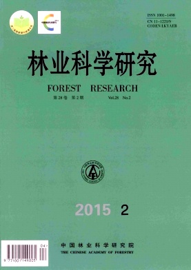
Monitoring and Analysis of Vegetation Fractional Cover in Changsha-Zhuzhou-Xiangtan Core Region Based on Remote Sensing Data

  • Received Date: 2014-11-10
  • Based on current status and temporal dynamics of the vegetation fractional cover in Changsha-Zhuzhou-Xiangtan (CZT) core region, the factors leading to the change and the direction of the evolution of the vegetation fractional cover were discussed. The Landsat 5/8 data in 2000 and 2013 were used to derive the vegetation fractional cover in CZT core region. And through image analyzing and processing, the NDVI values of pure vegetation and pure soil in such two periods were obtained. Then the vegetation fractional cover distribution maps in 2000 and 2013 were got by conducting the pixel dichotomy model. At last, the temporal and spatial changes of vegetation fractional cover, such as transfer matrixes, the vegetation improvement/degradation and the driving forces which lead to such changes were analyzed. The conclusions of quantitative analysis showed that the mean vegetation fractional cover of CZT core region has been improved from 0.573 9 in 2000 to 0.601 5 in 2013. Most of vegetation degradation occurred in Changsha, Zhuzhou, Xiangtan and the surrounding area. In particular, the vegetation fractional cover in Green-core of CZT declined a little bit. The driving forces analysis showed that the changes of vegetation fractional cover in CZT core region were correlated with the climate change, while the population growth, land-use change, urbanization and policy were the key factors influencing the vegetation fractional cover.
  • 加载中
  • [1]

    DetwilerR P, Hall C A. Tropical forest and the global cycles[J].Science,1988,239(4835):42-47.
    [2]

    Gutman G, Ignalov A. The derivation of the green vegetation fraction from NOAA/AVHRR data for use in numerical weather prediction models[J]. Int J Remote Sens,1998,19(8):1533-1543.
    [3]

    Guli Jiapaer, Xi Chen, Anming Bao. A comparison of methods for estimating fractional vegetation cover in arid regions [J].Agricultural and Forest Meteorology, 2011,151(12):1698-1710.
    [4] 杨景成,韩兴国,黄建辉,等.土地利用变化对陆地生态系统碳贮量的影响[J].应用生态学报,2003, 14(8):1385-1390.

    [5] 易 浪,任志远,张 翀,等.黄土高原植被覆盖变化与气候和人类活动的关系[J].资源科学, 2014,36(1):168-176.

    [6] 历 华,柳钦火,邹 杰,等.基于MODIS数据的长株潭地区NDBI和NDVI与地表温度的关系研究[J]. 地理科学,2009,29(2): 118-123.

    [7] 历 华,曾永年,贠培东,等.基于MODIS数据的长株潭地区城市热岛时空分析[J]. 测绘科学,2007,32(5):109-111.

    [8] 孙 禹,哈斯·额尔敦,杜会石,等.植被盖度在土壤侵蚀模数计算中的应用[J]. 水土保持通报, 2013,33(5):191-195.

    [9] 高国林.长江干流宜宾段植被覆盖变化遥感分析[D]. 成都:四川师范大学,2013.

    [10] 卢善龙,吴炳方,闫娜娜,等.河川径流遥感监测研究进展[J].地球科学进展,2010,25(8):42-48.

    [11] 田海静,曹春香,戴晟懋,等.准格尔旗植被覆盖度变化的时间序列遥感监测[J]. 地球信息科学学报,2014,16(1):130-137.

    [12] 罗慧芬,苗 放,叶成名,等.汶川地震前后茂县植被覆盖度变化研究[J]. 水土保持通报,2013,33(3):208-211.

    [13] 马 娜,胡云锋,庄大方,等.基于遥感和像元二分模型的内蒙古正蓝旗植被覆盖度格局和动态变化[J]. 地理科学,2012,32(2): 126-131.

    [14] 陈 晋,陈云浩,何春阳,等.基于土地覆盖分类的植被覆盖率估算亚像元模型与应用[J]. 遥感学报,2001,5(6):17-23.

    [15] 黄秋燕,于 刚,丁 琳.都安县植被覆盖度动态变化的遥感反演及驱动力分析[J]. 南方国土资源,2008(9):36-39.

    [16] 王 浩,李文龙,杜国祯,等.基于3S技术的甘南草地覆盖度动态变化研究[J]. 草业学报, 2012,21(3):29-40.

    [17] 党 青,杨武年.近20年成都市植被覆盖度动态变化检测及原因分析[J]. 国土资源遥感, 2011,23(4):124-128.

    [18] 陈 骏,沈盈佳,曾建军,等.基于RS的昆明市植被覆盖度变化动态分析[J]. 林业调查规划 2013,38(5):14-17.

    [19] 郭芬芬,范建容,严 冬,等. 基于像元二分模型的昌都县植被盖度遥感估算[J].中国水土保持,2010(5):69-71.

    [20] 陈 巧,陈永富,鞠洪波.基于3S技术的天保区植被变化监测方法研究[J]. 林业科学研究,2013, 26(6):736-743.

    [21] 董喜春,汤剑平,王 元,等. 长江中下游地区城市化进程中地表植被变化气候效应的数值模拟[J].气象科学,2008,28(2): 33-40.

    [22] 刘 越,Shintaro Goto,庄大方,等. 城市地表热通量遥感反演及与下垫面关系分析[J]. 地理学报,2012,67(1): 103-114.

    [23] 吴建强,黄沈发,黄宇弛,等. 污染负荷及植被生物量变化对缓冲带污染物净化效果的影响[J].环境工程学报,2008,2(10): 131-135.

    [24] 徐赛萍,沙晋明,刘玉琴,等. 城市热岛效应对植被生态环境质量的响应研究——以福州市马尾区为例[J].福建师范大学学报:自然科学版,2014,30(3):137-146.

  • 加载中
通讯作者: 陈斌, bchen63@163.com
  • 1. 

    沈阳化工大学材料科学与工程学院 沈阳 110142

  1. 本站搜索
  2. 百度学术搜索
  3. 万方数据库搜索
  4. CNKI搜索

Article views(3223) PDF downloads(1078) Cited by()

Proportional views

Monitoring and Analysis of Vegetation Fractional Cover in Changsha-Zhuzhou-Xiangtan Core Region Based on Remote Sensing Data

  • 1. College of Resources and Environment, Hunan Agricultural University, Changsha 410128, Hunan, China
  • 2. College of Business, Hunan Agricultural University, Changsha 410128, Hunan, China
  • 3. Hunan Environmental Monitoring Center Station, Changsha 410019, Hunan, China

Abstract: Based on current status and temporal dynamics of the vegetation fractional cover in Changsha-Zhuzhou-Xiangtan (CZT) core region, the factors leading to the change and the direction of the evolution of the vegetation fractional cover were discussed. The Landsat 5/8 data in 2000 and 2013 were used to derive the vegetation fractional cover in CZT core region. And through image analyzing and processing, the NDVI values of pure vegetation and pure soil in such two periods were obtained. Then the vegetation fractional cover distribution maps in 2000 and 2013 were got by conducting the pixel dichotomy model. At last, the temporal and spatial changes of vegetation fractional cover, such as transfer matrixes, the vegetation improvement/degradation and the driving forces which lead to such changes were analyzed. The conclusions of quantitative analysis showed that the mean vegetation fractional cover of CZT core region has been improved from 0.573 9 in 2000 to 0.601 5 in 2013. Most of vegetation degradation occurred in Changsha, Zhuzhou, Xiangtan and the surrounding area. In particular, the vegetation fractional cover in Green-core of CZT declined a little bit. The driving forces analysis showed that the changes of vegetation fractional cover in CZT core region were correlated with the climate change, while the population growth, land-use change, urbanization and policy were the key factors influencing the vegetation fractional cover.

Reference (24)

Catalog

    /

    DownLoad:  Full-Size Img  PowerPoint
    Return
    Return